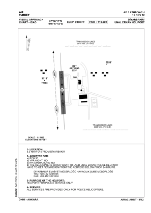
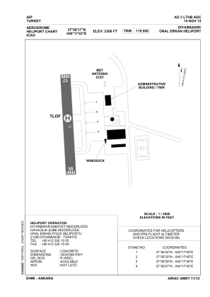


LTHB - Diyarbakir Unal Erkan Police Heliport
Located in Diyarbakir, Turkey
ICAO - , IATA -
Data provided by AirmateGeneral information
Coordinates: N37°56'17" E40°17'43"
Elevation is 2300 feet MSL.
Magnetic variation is 4.29° East View others Airports in Diyarbakir
Operational data
Special qualification required
Current time UTC:
Current local time:
Weather at : LTCC - Diyarbakir ( 10 km )
METAR: LTCC 151120Z 25005KT 200V300 9999 FEW040 SCT100 BKN200 23/05 Q1014 NOSIG
TAF: TAF LTCC 151040Z 1512/1612 VRB02KT 9999 FEW040 SCT100 TEMPO 1512/1516 VRB12G22KT -TSRA FEW015CB BKN035 BKN090 BECMG 1518/1520 CAVOK BECMG 1606/1608 FEW040 SCT100
Communications frequencies: [VIEW]
Runways:
Airport contact information
Address: Diyarbakir Turkey