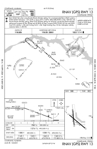


9A4 - Courtland
Located in Courtland, United States
ICAO - 9A4, IATA -
Data provided by AirmateGeneral information
Coordinates: N34°39'29" W87°20'55"
Elevation is 588 feet MSL.
Magnetic variation is -03° East View others Airports in Alabama
Operational data
Special qualification required
Current time UTC:
Current local time:
Weather at : KMSL - Northwest Alabama Rgnl ( 26 km )
METAR: KMSL 180053Z AUTO 00000KT 10SM SCT022 BKN039 OVC055 23/19 A2980 RMK AO2 SLP084 T02280194
TAF: KMSL 172320Z 1800/1824 00000KT P6SM SCT020 BKN025 OVC045 FM180600 VRB02KT P6SM VCSH BKN009 OVC025 FM180900 00000KT 3SM BR OVC002 FM181400 24006KT P6SM VCSH BKN016 OVC030 FM181700 25007KT P6SM VCTS SCT030 BKN040CB
Communications frequencies: [VIEW]
Runways:
| RWY identifier | QFU | Length (ft) | Width (ft) | Surface | LDA (ft) |
| 13 | 130° | 4994 | 100 | CONC | |
| 31 | 310° | 4994 | 100 | CONC | |
| 18 | 175° | 3484 | 150 | CONC | |
| 36 | 355° | 3484 | 150 | CONC |
Airport contact information
Address: Courtland United States