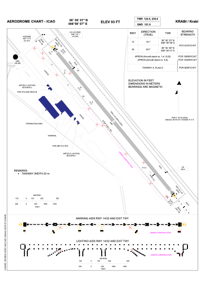


VTSG - Krabi / Krabi Airport
Located in Krabi, Thailand
ICAO - VTSG, IATA - KBV
Data provided by AirmateGeneral information
Coordinates: N8°6'1" E98°59'7"
Elevation is 93 feet MSL.
View others Airports in Krabi Province
Operational data
Special qualification required
Current time UTC:
Current local time:
Weather
METAR: VTSG 060100Z VRB02KT 9999 FEW023 30/27 Q1010 NOSIG
TAF: TAF VTSG 052300Z 0600/0624 00000KT 9999 SCT020 BECMG 0604/0606 20008KT TEMPO 0606/0612 -TSRA FEW018CB SCT020 BKN100 BECMG 0612/0614 00000KT
Communications frequencies: [VIEW]
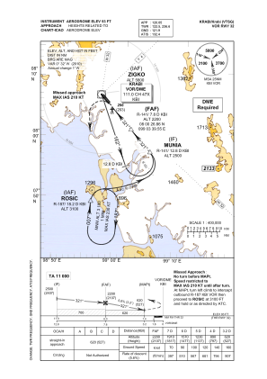
Runways:
| RWY identifier | QFU | Length (ft) | Width (ft) | Surface | LDA (ft) |
| 14 | 141° | 9843 | 148 | ASP | |
| 32 | 321° | 9843 | 148 | ASP |
Airport contact information
Address: Krabi Thailand