


VEBS - Biju Patnaik International Airport, Bhubaneswar
Located in Bhubaneswar, India
ICAO - VEBS, IATA - BBI
Data provided by AirmateGeneral information
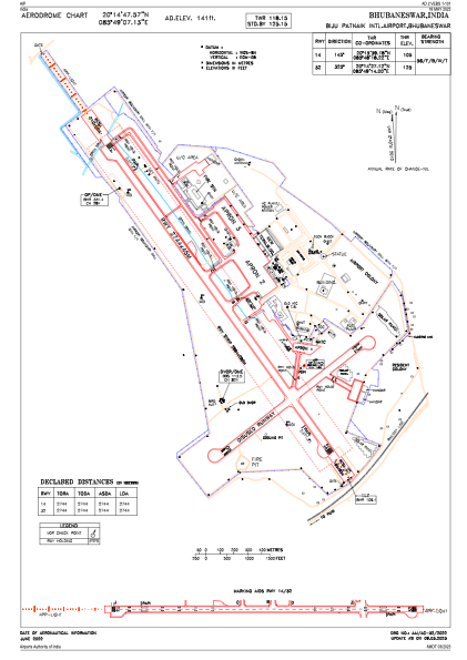
Coordinates: N20°14'48" E85°49'7"
Elevation is 138 feet MSL.
View others Airports in Odisha
Operational data
Special qualification required
Current time UTC:
Current local time:
Weather
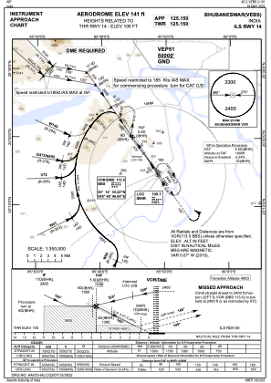
METAR: VEBS 281200Z 19009KT 5000 HZ SCT020 FEW030CB 37/24 Q1004 NOSIG
TAF: TAF VEBS 281100Z 2812/2821 17008KT 5000 HZ FEW020 BECMG 2813/2815 16006KT 4000 HZ NSC
Communications frequencies: [VIEW]
Runways:
| RWY identifier | QFU | Length (ft) | Width (ft) | Surface | LDA (ft) |
| 14 | 144° | 9003 | 148 | BIT | |
| 32 | 324° | 9003 | 148 | BIT |
Airport contact information
Address: Bhubaneswar India