


UBBG - Ganja
Located in Ganja, Azerbaijan
ICAO - UBBG, IATA - GNJ
Data provided by AirmateGeneral information
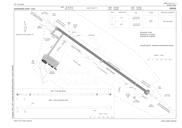
Coordinates: N40°44'20" E46°19'12"
Elevation is 1086 feet MSL.
Magnetic variation is 6° East View others Airports in Ganca
Operational data
Special qualification required
Current time UTC:
Current local time:
Weather
METAR: UBBG 280000Z 27004KT 240V300 9999 FEW100 13/10 Q1022 NOSIG
TAF: TAF UBBG 272300Z 2800/2824 VRB04KT 9999 FEW100 TX27/2812Z TN14/2802Z TEMPO 2800/2806 30008KT BECMG 2810/2812 09010KT BECMG 2817/2819 VRB04KT
Communications frequencies: [VIEW]
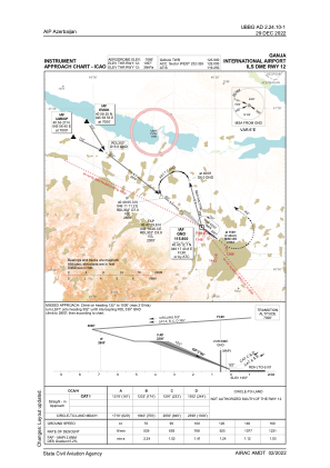
Runways:
| RWY identifier | QFU | Length (ft) | Width (ft) | Surface | LDA (ft) |
| 12 | 128° | 10827 | 148 | CONC+ASPH | 10827 |
| 30 | 308° | 10827 | 148 | CONC+ASPH | 10827 |
Airport contact information
Address: Ganja Azerbaijan