


TA56 - Floyd Ranch
Located in Orange Grove, United States
ICAO - TA56, IATA -
Data provided by AirmateGeneral information
Coordinates: N28°3'24" W98°8'31"
Elevation is 282 feet MSL.
View others Airports in Texas
Operational data
Special qualification required
Current time UTC:
Current local time:
Weather at : KNOG - Orange Grove Nalf ( 20 km )
METAR: KNOG 161656Z AUTO 14011KT 5SM HZ SCT018 BKN027 OVC035 34/25 A2969 RMK AO2 SLP033 T03390250 $
Communications frequencies: [VIEW]
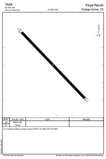
Runways:
| RWY identifier | QFU | Length (ft) | Width (ft) | Surface | LDA (ft) |
| 13 | 0° | 3000 | 30 | ASPH | |
| 31 | 0° | 3000 | 30 | ASPH |
Airport contact information
Address: Orange Grove United States