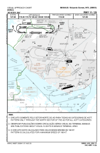
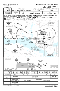
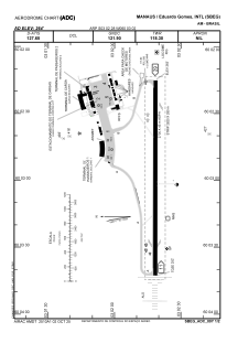


SBEG - Eduardo Gomes
Located in Manaus, Brazil
ICAO - SBEG, IATA - MAO
Data provided by AirmateGeneral information
Coordinates: S3°2'28" W60°3'2"
Elevation is 264 feet MSL.
Magnetic variation is -16.433333333° East View others Airports in Amazonas
Operational data
Special qualification required
Current time UTC:
Current local time:
Weather
METAR: SBEG 162300Z 01002KT 9999 FEW020 26/26 Q1010
TAF: TAF SBEG 162100Z 1700/1724 35005KT 9999 SCT015 TN25/1708Z TX31/1716Z PROB30 TEMPO 1700/1705 TS SCT020 FEW025CB BECMG 1713/1715 25005KT SCT020 BECMG 1719/1721 34005KT SCT025 RMK PHD
Communications frequencies: [VIEW]
Runways:
| RWY identifier | QFU | Length (ft) | Width (ft) | Surface | LDA (ft) |
| 11 | 90° | 9252 | 984 | ASPH | |
| 29 | 270° | 9252 | 984 | ASPH |
Airport contact information
Address: Manaus Brazil