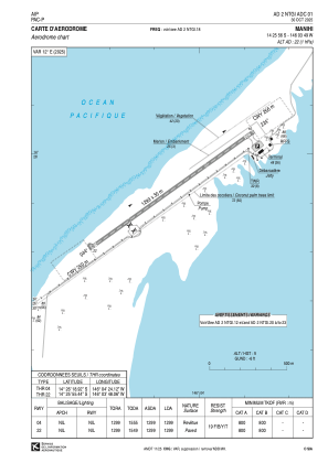


NTGI - Manihi
Located in Paeva, French Polynesia
ICAO - NTGI, IATA - XMH
Data provided by AirmateGeneral information
Coordinates: S14°25'56" W146°3'49"
Elevation is 22 feet MSL.
Magnetic variation is 12.04° East View others Airports in (unassigned)
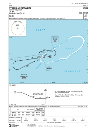
Operational data
Special qualification required
Current time UTC:
Current local time:
Weather at : - ( 0 km )
METAR: NZCM 120148Z AUTO 07004KT 8000 OVC035 M23/M28 A2892 RMK AO2 SNE0109B0119E0133B0134E0148 SLP800 T12331277 $
Communications frequencies: [VIEW]
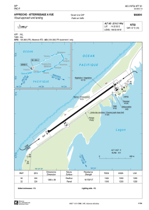
Runways:
| RWY identifier | QFU | Length (ft) | Width (ft) | Surface | LDA (ft) |
| 04 | 56° | 4281 | 98 | ASPH | 4232 |
| 22 | 236° | 4281 | 98 | ASPH | 4262 |
Airport contact information
Address: Paeva French Polynesia