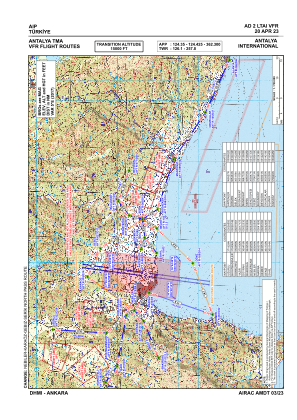
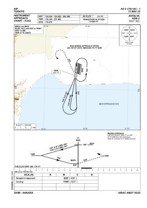
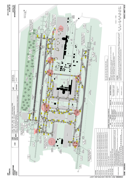


LTAI - Antalya
Located in Antalya, Turkey
ICAO - LTAI, IATA - AYT
Data provided by AirmateGeneral information
Coordinates: N36°54'1" E30°47'34"
Elevation is 177 feet MSL.
Magnetic variation is 5.0° East View others Airports in Antalya
Operational data
Special qualification required
Current time UTC:
Current local time:
Weather
METAR: LTAI 301650Z 20006KT 160V250 9999 FEW030 SCT120 27/15 Q1009 NOSIG RMK RWY18C 22004KT 180V260 RWY36R 20003KT 150V240 RWY18L 19005KT
TAF: TAF LTAI 301640Z 3018/0118 34006KT CAVOK BECMG 0106/0109 16010KT SCT030 TEMPO 0112/0116 FEW020CB BKN030 BECMG 0115/0118 34006KT CAVOK
Communications frequencies: [VIEW]
Runways:
| RWY identifier | QFU | Length (ft) | Width (ft) | Surface | LDA (ft) |
| 18L | 186° | 11155 | 148 | CONC | 11155 |
| 36R | 6° | 11155 | 148 | CONC | 11155 |
| 18C | 186° | 11155 | 148 | CONC | 11155 |
| 36C | 6° | 11155 | 148 | CONC | 11155 |
| 18R | 186° | 9810 | 148 | ASPH | 9810 |
| 36L | 6° | 9810 | 148 | ASPH | 9810 |
Airport contact information
Address: Antalya Turkey