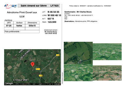


LF7925 - Saint Amand sur Sèvre
Located in Saint-Amand-sur-Sèvre, France
ICAO - , IATA -
Data provided by AirmateGeneral information
Coordinates: N46°54'5" W0°48'10"
Elevation is 607 feet MSL.
View others Airports in Poitou-Charentes
Operational data
Special qualification required
Current time UTC:
Current local time:
Weather at : LFRI - La Roche Sur Yon Les Ajoncs ( 49 km )
TAF: TAF LFRI 071700Z 0718/0818 01007KT 9999 SCT040 TEMPO 0802/0808 3000 BR PROB40 TEMPO 0802/0807 0300 FG VV///
Communications frequencies: [VIEW]
Runways:
| RWY identifier | QFU | Length (ft) | Width (ft) | Surface | LDA (ft) |
| 07 | 0° | 1738 | 49 | GRASS | |
| 25 | 0° | 1738 | 49 | GRASS |
Airport contact information
Address: Saint-Amand-sur-Sèvre France