


KCBM - Columbus Afb
Located in Columbus, United States
ICAO - CBM, IATA - CBM
Data provided by AirmateGeneral information
Coordinates: N33°38'43" W88°26'45"
Elevation is 218 feet MSL.
Magnetic variation is 00° East View others Airports in Mississippi
Operational data
Special qualification required
Current time UTC:
Current local time:
Weather
METAR: KCBM 150555Z AUTO 00000KT 10SM CLR 18/17 A2969 RMK AO2 SLP055 T01800170 10244 20180 402780180 50004 $
TAF: TAF AMD KCBM 150330Z 1503/1607 31006KT 9999 BKN035 QNH2965INS BECMG 1512/1513 31012G18KT 9999 SCT040 QNH2971INS BECMG 1522/1523 34006KT 9999 BKN030 QNH2971INS TX28/1521Z TN15/1511Z LAST NO AMD AFT 1503 NEXT 1509
Communications frequencies: [VIEW]
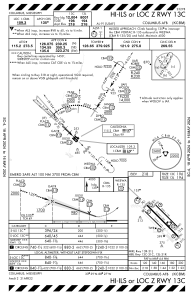
Runways:
| RWY identifier | QFU | Length (ft) | Width (ft) | Surface | LDA (ft) |
| 13C | 135° | 12004 | 300 | OTHER | |
| 31C | 315° | 12004 | 300 | OTHER | |
| 13L | 135° | 8001 | 150 | OTHER | |
| 31R | 315° | 8001 | 150 | OTHER | |
| 13R | 135° | 6320 | 175 | CONC | |
| 31L | 315° | 6320 | 175 | CONC |
Airport contact information
Address: Columbus United States