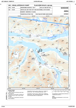
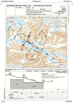
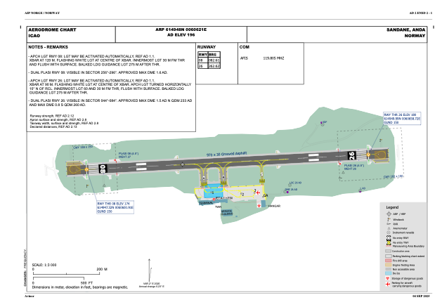


ENSD - Anda
Located in Sandane, Norway
ICAO - ENSD, IATA - SDN
Data provided by AirmateGeneral information
Coordinates: N61°49'48" E6°6'21"
Elevation is 195 feet MSL.
Magnetic variation is 1.8° East View others Airports in Sogn og Fjordane
Operational data
Special qualification required
Current time UTC:
Current local time:
Weather
METAR: ENSD 082350Z AUTO 19008KT 110V280 9999 OVC044/// 12/03 Q1020 RMK WIND RWY 26 VRB07KT WIND 1140FT VRB08G18KT
Communications frequencies: [VIEW]
Runways:
| RWY identifier | QFU | Length (ft) | Width (ft) | Surface | LDA (ft) |
| 08 | 0° | 3182 | 98 | UNK | |
| 26 | 0° | 3182 | 98 | UNK |
Airport contact information
Address: Sandane Norway