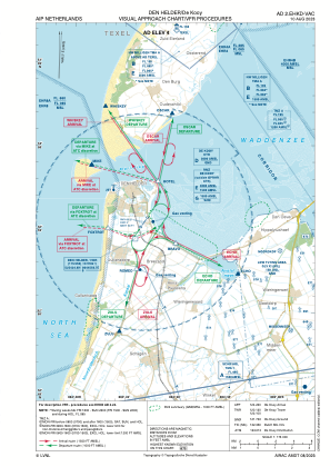
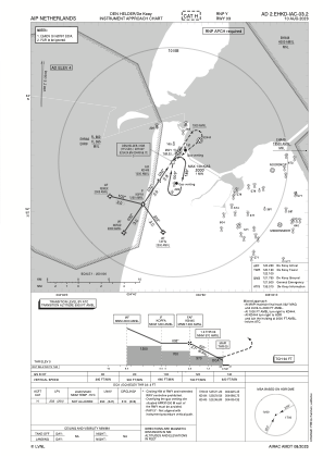
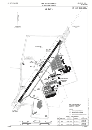


EHKD - Den Helder/De Kooy
Located in Den Helder, Netherlands
ICAO - EHKD, IATA - DHR
Data provided by AirmateGeneral information
Coordinates: N52°55'25" E4°46'50"
Elevation is 4 feet MSL.
Magnetic variation is +1.583° East View others Airports in Noord-Holland
Operational data
Special qualification required
Current time UTC:
Current local time:
Weather
METAR: EHKD 271025Z AUTO 23014KT 200V260 9999 FEW014 BKN016 BKN024 15/11 Q1016 WHT NOSIG
TAF: TAF EHKD 270827Z 2709/2721 23014KT 9999 FEW012 SCT016 BECMG 2709/2711 FEW016 SCT020
Communications frequencies: [VIEW]
Runways:
| RWY identifier | QFU | Length (ft) | Width (ft) | Surface | LDA (ft) |
| 03 | 34° | 4184 | 98 | CONC+ASPH | 3334 |
| 21 | 214° | 4184 | 98 | CONC+ASPH | 3377 |
Airport contact information
Address: Den Helder Netherlands
