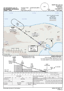
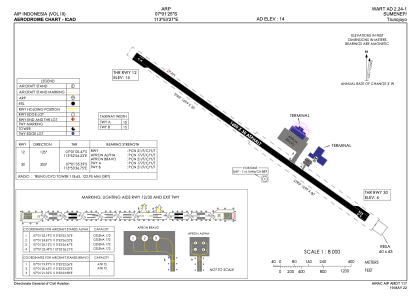


WART - Sumenep / Trunojoyo
Located in Sumenep, Indonesia
ICAO - WART, IATA - SUP
Data provided by AirmateGeneral information
Coordinates: S7°1'25" E113°53'27"
Elevation is 14 feet MSL.
View others Airports in Jawa Timur
Operational data
Special qualification required
Current time UTC:
Current local time:
Weather at : - ( 0 km )
METAR: PAFS 130901Z AUTO 18003KT 10SM SCT055 BKN085 04/01 A2965 RMK AO2 SLP047 T00440006 400440044 53017
Communications frequencies: [VIEW]
Runways:
| RWY identifier | QFU | Length (ft) | Width (ft) | Surface | LDA (ft) |
| 12 | 125° | 5249 | 98 | ASP | |
| 30 | 305° | 5249 | 98 | ASP |
Airport contact information
Address: Sumenep Indonesia