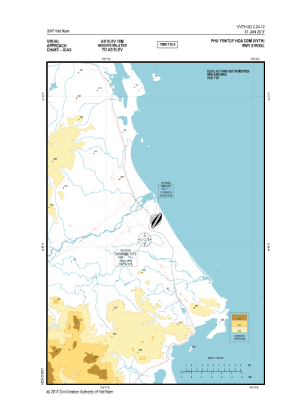
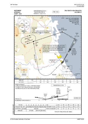
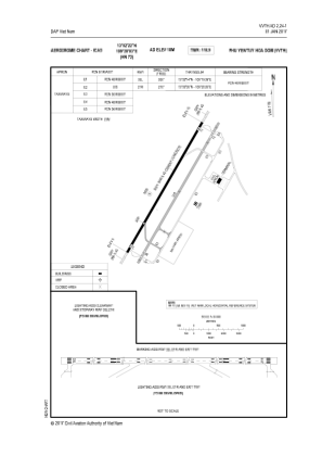


VVTH - Dong Tac Airport
Located in Tuy Hoa, Viet Nam
ICAO - VVTH, IATA - TBB
Data provided by AirmateGeneral information
Coordinates: N13°2'32" E109°19'49"
Elevation is 26 feet MSL.
View others Airports in Vinh Long
Operational data
Special qualification required
Current time UTC:
Current local time:
Weather at : - ( 0 km )
METAR: CYZE 290023Z AUTO 06017KT 9SM BKN060 OVC091 10/04 A3009 RMK PRESFR SLP196
Communications frequencies: [VIEW]
Runways:
| RWY identifier | QFU | Length (ft) | Width (ft) | Surface | LDA (ft) |
| 03 | 0° | 9514 | 148 | UNK | |
| 21 | 0° | 9514 | 148 | UNK |
Airport contact information
Address: Tuy Hoa Viet Nam