


VVCT - Can Tho/Can Tho International
Located in Can Tho, Viet Nam
ICAO - VVCT, IATA - VCA
Data provided by AirmateGeneral information
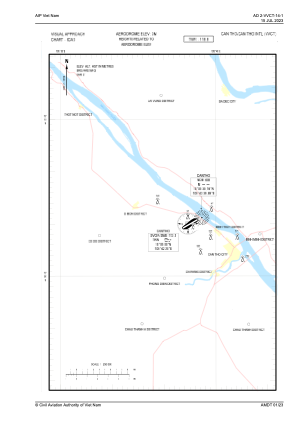
Coordinates: N10°5'2" E105°42'36"
Elevation is 10 feet MSL.
View others Airports in Lao Cai
Operational data
Special qualification required
Current time UTC:
Current local time:
Weather
METAR: VVCT 292200Z 19003KT 9999 FEW015 27/27 Q1007 NOSIG
TAF: TAF VVCT 291700Z 2918/3018 VRB03KT 9999 SCT015 BECMG 2922/2923 5000 BR BECMG 3001/3002 24010KT 9999 NSW
Communications frequencies: [VIEW]
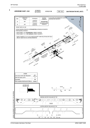
Runways:
| RWY identifier | QFU | Length (ft) | Width (ft) | Surface | LDA (ft) |
| 06 | 60° | 9843 | 148 | ASP | |
| 24 | 240° | 9843 | 148 | ASP |
Airport contact information
Address: Can Tho Viet Nam