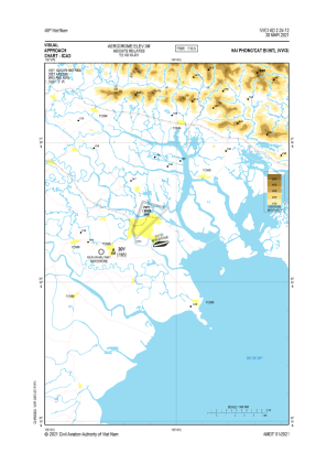
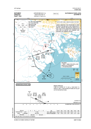
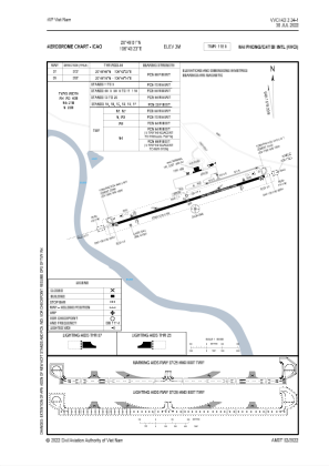


VVCI - Hai Phong / Cat Bi International
Located in Hai Phong, Viet Nam
ICAO - VVCI, IATA - HPH
Data provided by AirmateGeneral information
Coordinates: N20°49'1" E106°43'23"
Elevation is 9 feet MSL.
Magnetic variation is -2° East View others Airports in Hai Duong
Operational data
Special qualification required
Current time UTC:
Current local time:
Weather at : - ( 0 km )
METAR: LWSK 281450Z VRB02KT CAVOK 26/11 Q1019 NOSIG
Communications frequencies: [VIEW]
Runways:
| RWY identifier | QFU | Length (ft) | Width (ft) | Surface | LDA (ft) |
| 07 | 72° | 10007 | 148 | ASP | |
| 25 | 252° | 10007 | 148 | ASP |
Airport contact information
Address: Hai Phong Viet Nam