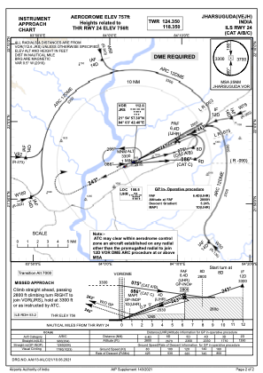
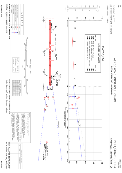


VEJH - Veer Surendra Sai Airport, Jharsuguda
Located in Jharsuguda, India
ICAO - VEJH, IATA - JRG
Data provided by AirmateGeneral information
Coordinates: N21°54'53" E84°2'55"
Elevation is 757 feet MSL.
View others Airports in Odisha
Operational data
Special qualification required
Current time UTC:
Current local time:
Weather
METAR: VEJH 171300Z 27004KT 6000 BKN018 OVC080 33/23 Q1006
TAF: TAF VEJH 170800Z 1709/1718 27006KT 6000 SCT020 OVC090 TEMPO 1710/1714 08010KT 1500 TSRA BKN015 FEW030CB OVC080 BECMG 1715/1717 22006KT 4000 HZ SCT018 SCT100
Communications frequencies: [VIEW]
Runways:
| RWY identifier | QFU | Length (ft) | Width (ft) | Surface | LDA (ft) |
| 06 | 63° | 7844 | 148 | CON | |
| 24 | 243° | 7844 | 148 | CON |
Airport contact information
Address: Jharsuguda India