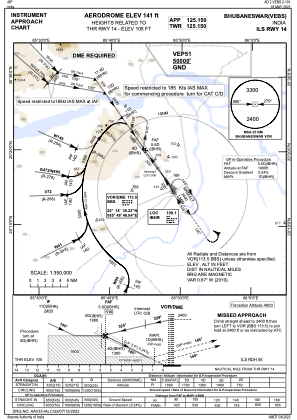
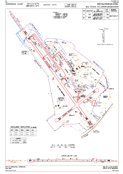


VEBS - Biju Patnaik International Airport, Bhubaneswar
Located in Bhubaneswar, India
ICAO - VEBS, IATA - BBI
Data provided by AirmateGeneral information
Coordinates: N20°14'48" E85°49'7"
Elevation is 138 feet MSL.
View others Airports in Odisha
Operational data
Special qualification required
Current time UTC:
Current local time:
Weather
METAR: VEBS 170200Z 23004KT 6000 SCT020 BKN100 30/25 Q1010 NOSIG
TAF: TAF VEBS 162300Z 1700/1806 20006KT 3500 HZ SCT020 BECMG 1703/1705 20006KT 5000 HZ FEW020 BECMG 1713/1715 18006KT 4000 HZ BECMG 1803/1805 5000 HZ
Communications frequencies: [VIEW]
Runways:
| RWY identifier | QFU | Length (ft) | Width (ft) | Surface | LDA (ft) |
| 14 | 144° | 9003 | 148 | BIT | |
| 32 | 324° | 9003 | 148 | BIT |
Airport contact information
Address: Bhubaneswar India