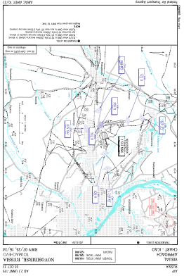
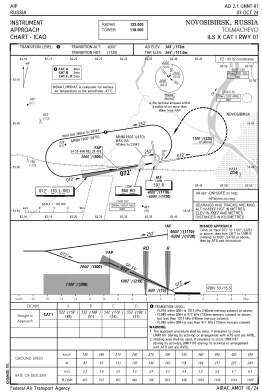
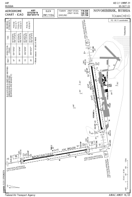


UNNT - Novosibirsk/Tolmachevo
Located in Novosibirsk, Russian Federation
ICAO - UNNT, IATA - OVB
Data provided by AirmateGeneral information
Coordinates: N55°1'60" E82°35'57"
Elevation is 367 feet MSL.
View others Airports in Novosibirsk Oblast
Operational data
Special qualification required
Current time UTC:
Current local time:
Weather
METAR: UNNT 180100Z 21003MPS CAVOK 13/02 Q1012 R25/090070 R16/////// NOSIG RMK QFE749/0999
TAF: TAF UNNT 172300Z 1800/1824 23003G08MPS 8000 SCT040CB TX24/1809Z TN10/1823Z BECMG 1806/1808 18003G08MPS
Communications frequencies: [VIEW]
Runways:
| RWY identifier | QFU | Length (ft) | Width (ft) | Surface | LDA (ft) |
| 16 | 170° | 11818 | 148 | ASP | |
| 34 | 350° | 11818 | 148 | ASP | |
| 07 | 81° | 11801 | 197 | ASP | |
| 25 | 261° | 11801 | 197 | ASP |
Airport contact information
Address: Novosibirsk Russian Federation