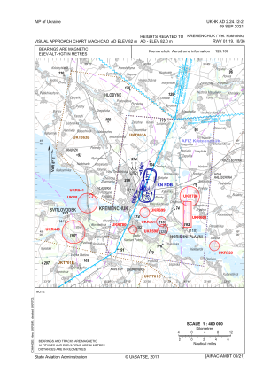
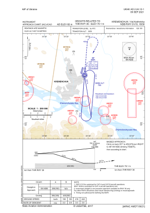
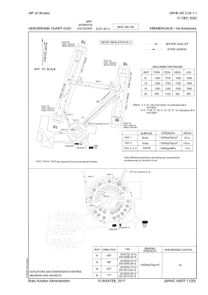


UKHK - Kremenchuk/Velyka Kokhnivka
Located in Kremenchuk, Ukraine
ICAO - , IATA - KHU
Data provided by AirmateGeneral information
Coordinates: N49°8'3" E33°28'36"
Elevation is 269 feet MSL.
Magnetic variation is 8° East View others Airports in Poltava
Operational data
Special qualification required
Current time UTC:
Current local time:
Communications frequencies: [VIEW]
Runways:
| RWY identifier | QFU | Length (ft) | Width (ft) | Surface | LDA (ft) |
| 01 | 14° | 5249 | 246 | GRASS | 5085 |
| 19 | 194° | 5249 | 246 | GRASS | 5085 |
| 18 | 185° | 3281 | 361 | GRASS | 3281 |
| 36 | 5° | 3281 | 361 | GRASS | 3117 |
Airport contact information
Address: Kremenchuk Ukraine