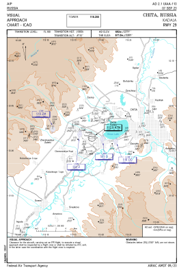

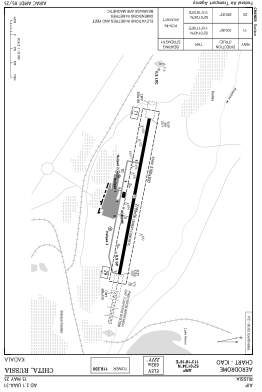


UIAA - Chita/Kadala
Located in Chita, Russian Federation
ICAO - UIAA, IATA - HTA
Data provided by AirmateGeneral information
Coordinates: N52°1'34" E113°18'18"
Elevation is 2270 feet MSL.
View others Airports in Zabaykalsky Krai
Operational data
Special qualification required
Current time UTC:
Current local time:
Weather
METAR: UIAA 161300Z 31002MPS 9999 SCT050CB 16/03 Q1003 R29/CLRD70 NOSIG RMK QFE694/0926
TAF: TAF UIAA 161100Z 1612/1712 30009G15MPS 9999 BKN030CB TEMPO 1612/1624 24003G08MPS TEMPO 1700/1712 33014G22MPS 3100 -SHRA
Communications frequencies: [VIEW]
Runways:
| RWY identifier | QFU | Length (ft) | Width (ft) | Surface | LDA (ft) |
| 11 | 101° | 9183 | 184 | CON | |
| 29 | 281° | 9183 | 184 | CON |
Airport contact information
Address: Chita Russian Federation