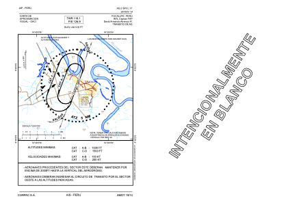
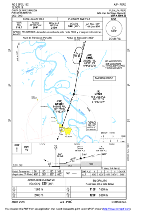
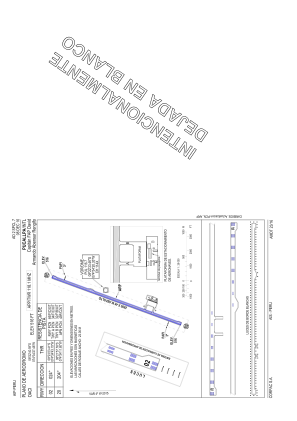


SPCL - Aeropuerto Intl. Capitan Fap David Armando Abensur Rengifo
Located in Pucallpa, Peru
ICAO - SPCL, IATA - PCL
Data provided by AirmateGeneral information
Coordinates: S8°22'41" W74°34'27"
Elevation is 516 feet MSL.
View others Airports in Ucayali Region
Operational data
Special qualification required
Current time UTC:
Current local time:
Weather
METAR: SPCL 211000Z 16007KT 9999 SCT015 22/21 Q1014 RMK PP000
TAF: TAF SPCL 210510Z 2106/2206 15004KT 9999 SCT015 SCT100 TX31/2120Z TN24/2111Z TEMPO 2109/2112 3000 BR BKN008 TEMPO 2118/2122 10012KT 4000 SHRA BKN012 FEW025TCU BKN080
Communications frequencies: [VIEW]
Runways:
| RWY identifier | QFU | Length (ft) | Width (ft) | Surface | LDA (ft) |
| 02 | 20° | 9186 | 148 | ASP | |
| 20 | 200° | 9186 | 148 | ASP |
Airport contact information
Address: Pucallpa Peru