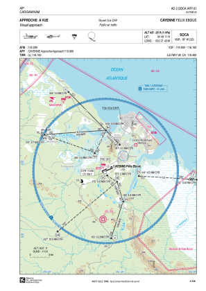
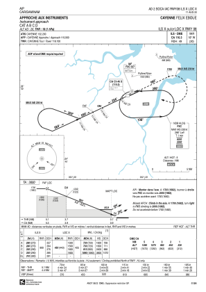
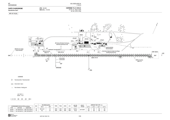


SOCA - Cayenne Felix Eboue
Located in Cayenne, French Guiana
ICAO - SOCA, IATA - CAY
Data provided by AirmateGeneral information
Coordinates: N4°49'11" W52°21'43"
Elevation is 26 feet MSL.
Magnetic variation is -18.43° East View others Airports in Cayenne
Operational data
Special qualification required
Current time UTC:
Current local time:
Weather
METAR: SOCA 291300Z AUTO 02007KT 9999 FEW015 SCT020 BKN027 28/27 Q1013 TEMPO 3000 SHRA SCT008 BKN015TCU
TAF: TAF SOCA 291100Z 2912/3012 08008KT 9999 BKN020 TEMPO 2912/3012 3000 SHRA SCT008 BKN015TCU PROB40 TEMPO 3000/3012 1000 SHRA BKN005 BKN012CB
Communications frequencies: [VIEW]
Runways:
| RWY identifier | QFU | Length (ft) | Width (ft) | Surface | LDA (ft) |
| 08 | 65° | 10515 | 148 | ASPH | 10515 |
| 26 | 245° | 10515 | 148 | ASPH | 10515 |
Airport contact information
Address: Cayenne French Guiana
