


SKBQ - Barranquilla-Ernesto Cortissoz
Located in Barranquilla, Colombia
ICAO - SKBQ, IATA - BAQ
Data provided by AirmateGeneral information
Coordinates: N10°53'22" W74°46'50"
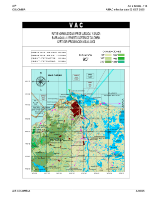
Elevation is 95 feet MSL.
Magnetic variation is -8° East View others Airports in Atlántico
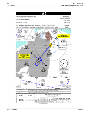
Operational data
Special qualification required
Current time UTC:
Current local time:
Weather
METAR: SKBQ 281400Z 16004KT 070V210 9999 FEW015 29/25 Q1011 NOSIG
TAF: TAF SKBQ 281030Z 2812/2912 21004KT 9999 SCT015 TEMPO 2812/2814 3000 BR BKN008 TEMPO 2816/2820 TSRA FEW015CB TX32/2818Z TN25/2910Z
Communications frequencies: [VIEW]
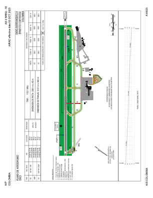
Runways:
| RWY identifier | QFU | Length (ft) | Width (ft) | Surface | LDA (ft) |
| 05 | 41° | 9846 | 148 | ASPH | 9846 |
| 23 | 221° | 9846 | 148 | ASPH | 9846 |
Airport contact information
Address: Barranquilla Colombia

