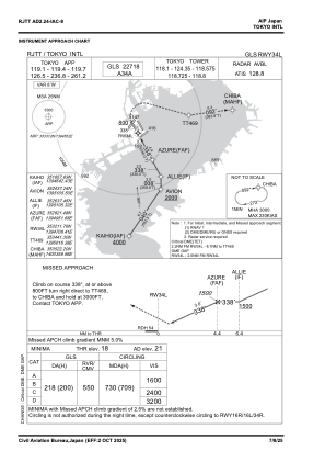
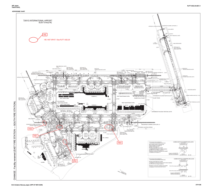


RJTT - Tokyo Intl
Located in Tokyo, Japan
ICAO - RJTT, IATA - HND
Data provided by AirmateGeneral information
Coordinates: N35°33'12" E139°46'52"
Elevation is 21 feet MSL.
View others Airports in Tokyo Prefecture
Operational data
Special qualification required
Current time UTC:
Current local time:
Weather
METAR: RJTT 270630Z 12004KT 9999 FEW020 BKN060 20/17 Q1010 NOSIG RMK 1CU020 7AC060 A2983
TAF: TAF RJTT 270506Z 2706/2812 12005KT 9999 FEW020 BKN040 BECMG 2709/2711 34004KT BECMG 2800/2803 12005KT BECMG 2803/2806 18014KT
Communications frequencies: [VIEW]
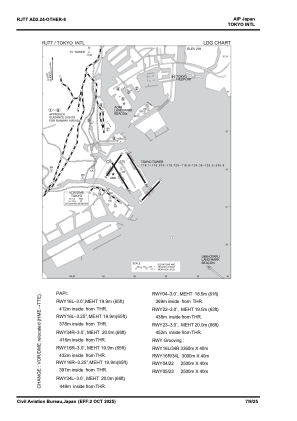
Runways:
| RWY identifier | QFU | Length (ft) | Width (ft) | Surface | LDA (ft) |
| 16L | 150° | 11024 | 197 | ASP | |
| 34R | 330° | 11024 | 197 | ASP | |
| 04 | 35° | 8202 | 197 | ASP | |
| 22 | 215° | 8202 | 197 | ASP | |
| 05 | 43° | 8202 | 197 | ASP | |
| 23 | 223° | 8202 | 197 | ASP | |
| 16R | 150° | 9843 | 197 | ASP | |
| 34L | 330° | 9843 | 197 | ASP |
Airport contact information
Address: Tokyo Japan