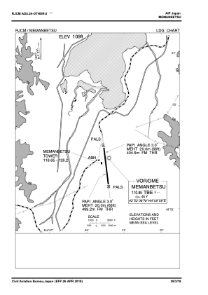
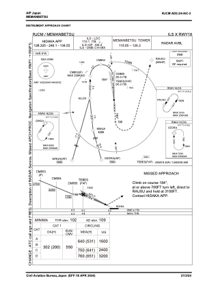
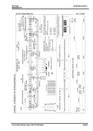


RJCM - Memanbetsu
Located in Abashiri, Japan
ICAO - RJCM, IATA - MMB
Data provided by AirmateGeneral information
Coordinates: N43°52'50" E144°9'51"
Elevation is 109 feet MSL.
View others Airports in Hokkaido Prefecture
Operational data
Special qualification required
Current time UTC:
Current local time:
Weather
TAF: TAF RJCM 291105Z 2912/3018 18006KT 9999 FEW030 BECMG 2922/3000 17018KT TEMPO 3003/3006 FEW003 BKN006 TEMPO 3006/3012 3000 SHRA BR FEW002 BKN005 BECMG 3009/3012 34010KT TEMPO 3012/3018 FEW003 BKN006
Communications frequencies: [VIEW]
Runways:
| RWY identifier | QFU | Length (ft) | Width (ft) | Surface | LDA (ft) |
| 18 | 175° | 8202 | 148 | ASP | |
| 36 | 355° | 8202 | 148 | ASP |
Airport contact information
Address: Abashiri Japan