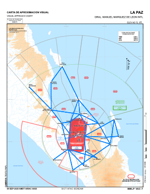
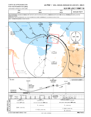
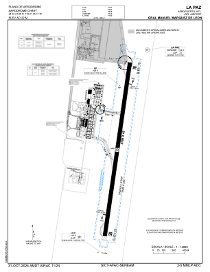


MMLP - La Paz Aeropuerto Internacional Gral. Manuel Marquez De Leon
Located in La Paz, Mexico
ICAO - MMLP, IATA - LAP
Data provided by AirmateGeneral information
Coordinates: N24°4'22" W110°21'45"
Elevation is 69 feet MSL.
View others Airports in Baja California Sur
Operational data
Special qualification required
Current time UTC:
Current local time:
Weather
METAR: MMLP 212345Z 34007KT 10SM FEW100 FEW220 33/07 A2976 RMK SLP078 57010 957 8/038
TAF: TAF MMLP 211705Z 2118/2218 35012KT P6SM SCT200 BECMG 2202/2203 30005KT FM221700 32010KT P6SM SKC
Communications frequencies: [VIEW]
Runways:
| RWY identifier | QFU | Length (ft) | Width (ft) | Surface | LDA (ft) |
| 18 | 188° | 8202 | 148 | CON | |
| 36 | 8° | 8202 | 148 | CON |
Airport contact information
Address: La Paz Mexico