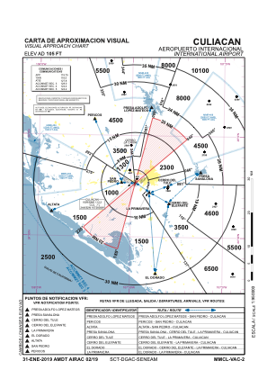
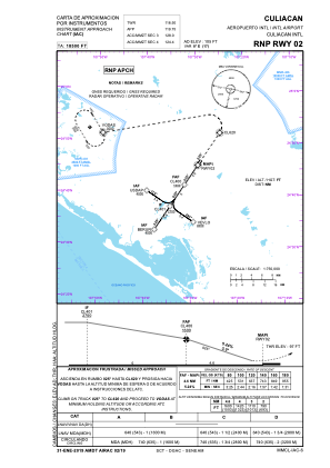
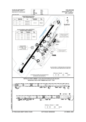


MMCL - Culiacan Sin. Aeropuerto Internacional
Located in Culiacan, Mexico
ICAO - MMCL, IATA - CUL
Data provided by AirmateGeneral information
Coordinates: N24°45'54" W107°28'31"
Elevation is 108 feet MSL.
View others Airports in Sinaloa
Operational data
Special qualification required
Current time UTC:
Current local time:
Weather
METAR: MMCL 271940Z 22010KT 10SM SCT250 33/01 A2984 RMK 8/002 HZY
TAF: TAF MMCL 271724Z 2718/2818 28010KT P6SM SCT250 FM280600 00000KT P6SM SKC FM281700 26010KT P6SM SCT250
Communications frequencies: [VIEW]
Runways:
| RWY identifier | QFU | Length (ft) | Width (ft) | Surface | LDA (ft) |
| 02 | 33° | 7365 | 148 | ASP | |
| 20 | 213° | 7365 | 148 | ASP |
Airport contact information
Address: Culiacan Mexico