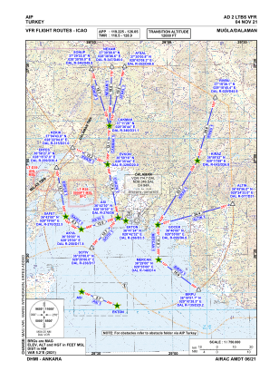
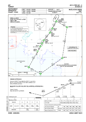
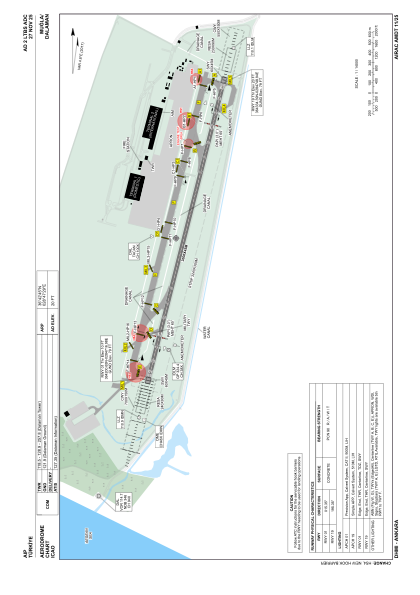


LTBS - Mugla Dalaman
Located in Dalaman, Turkey
ICAO - LTBS, IATA - DLM
Data provided by AirmateGeneral information
Coordinates: N36°42'45" E28°47'29"
Elevation is 20 feet MSL.
Magnetic variation is 4.8° East View others Airports in Mugla
Operational data
Special qualification required
Current time UTC:
Current local time:
Weather
METAR: LTBS 031720Z 25014KT 9999 FEW030 SCT180 20/17 Q1008 BECMG TL1800 VRB02KT RMK RWY19 24004KT 150V290 2CU030 4CI180
TAF: TAF LTBS 031640Z 0318/0418 VRB02KT 9999 FEW030 SCT120 BECMG 0406/0408 22013KT BKN030 BKN100 PROB30 TEMPO 0411/0415 4000 -TSRA FEW015CB BKN025
Communications frequencies: [VIEW]
Runways:
| RWY identifier | QFU | Length (ft) | Width (ft) | Surface | LDA (ft) |
| 01 | 15° | 9843 | 148 | CONC | 9843 |
| 19 | 195° | 9843 | 148 | CONC | 9843 |
Airport contact information
Address: Dalaman Turkey
