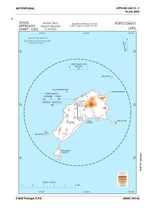
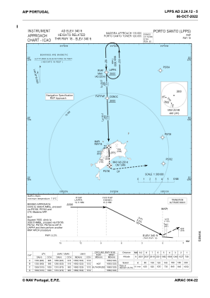
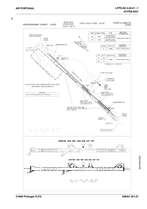


LPPS - Porto Santo
Located in Porto Santo, Portugal
ICAO - LPPS, IATA - PXO
Data provided by AirmateGeneral information
Coordinates: N33°4'15" W16°20'59"
Elevation is 339 feet MSL.
Magnetic variation is -004.3032° East View others Airports in Autonomous Region of Madeira
Operational data
Special qualification required
Current time UTC:
Current local time:
Weather
METAR: LPPS 171130Z 34009KT 310V020 9999 VCSH FEW006 SCT012 21/15 Q1019
TAF: TAF LPPS 171100Z 1712/1818 33010KT 9999 SCT012 SCT030 BECMG 1712/1714 01013KT TEMPO 1712/1722 6000 -RA SCT006 BKN012
Communications frequencies: [VIEW]
Runways:
| RWY identifier | QFU | Length (ft) | Width (ft) | Surface | LDA (ft) |
| 18 | 178° | 9843 | 148 | CON | |
| 36 | 358° | 9843 | 148 | CON |
Airport contact information
Address: Porto Santo Portugal
