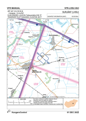
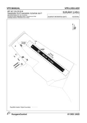


LHSU - Surjany
Located in Surjany, Hungary
ICAO - , IATA -
Data provided by AirmateGeneral information
Coordinates: N47°12'4" E20°28'48"
Elevation is 282 feet MSL.
View others Airports in Jász-Nagykun-Szolnok
Operational data
Special qualification required
Current time UTC:
Current local time:
Weather at : LHSN - Szolnok ( 20 km )
METAR: LHSN 032145Z 31009KT CAVOK 16/10 Q1008 NOSIG RMK BLU
TAF: TAF LHSN 032015Z 0321/0406 29008KT CAVOK BECMG 0321/0324 34006KT BECMG 0401/0404 04005KT TEMPO 0402/0406 VRB02KT 7000 MIFG NSC
Communications frequencies: [VIEW]
Runways:
| RWY identifier | QFU | Length (ft) | Width (ft) | Surface | LDA (ft) |
| 13 | 0° | 1969 | 164 | GRASS | |
| 31 | 0° | 1969 | 164 | GRASS |
Airport contact information
Address: Surjany Hungary