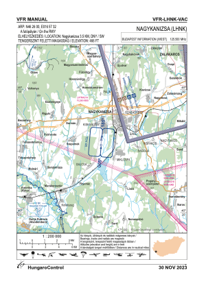
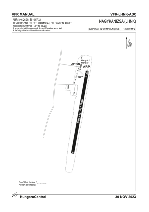


LHNK - Nagykanizsa
Located in Nagykanizsa, Hungary
ICAO - LHNK, IATA -
Data provided by AirmateGeneral information
Coordinates: N46°25'60" E16°57'32"
Elevation is 466 feet MSL.
View others Airports in Zala
Operational data
Special qualification required
Current time UTC:
Current local time:
Weather at : LHSM - Heviz-Balaton Airport ( 32 km )
METAR: LHSM 171315Z AUTO 21011KT 170V250 CAVOK 23/12 Q1009 NOSIG
TAF: TAF LHSM 171115Z 1712/1721 21012KT 9999 SCT035 TEMPO 1712/1715 SCT035CB BECMG 1715/1718 24005KT CAVOK
Communications frequencies: [VIEW]
Runways:
| RWY identifier | QFU | Length (ft) | Width (ft) | Surface | LDA (ft) |
| 01 | 0° | 3609 | 131 | GRASS | |
| 19 | 0° | 3609 | 131 | GRASS |
Airport contact information
Address: Nagykanizsa Hungary