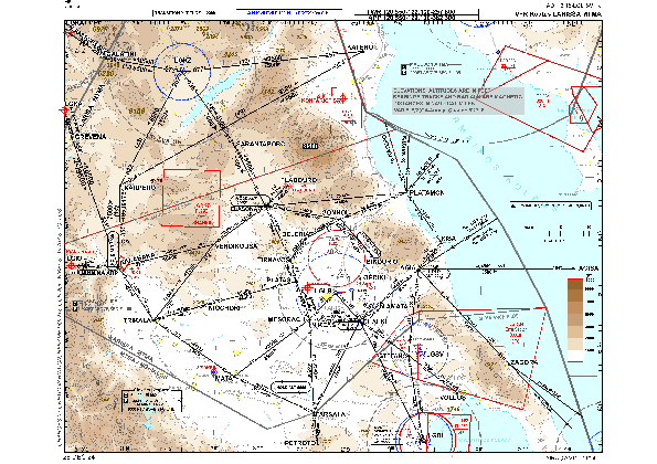
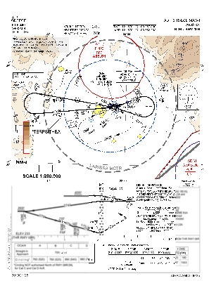


LGLR - Larissa
Located in Larissa, Greece
ICAO - LGLR, IATA - LRA
Data provided by AirmateGeneral information
Coordinates: N39°39'1" E22°27'55"
Elevation is 243 feet MSL.
View others Airports in Larissa
Operational data
Special qualification required
Current time UTC:
Current local time:
Weather
TAF: TAF LGLR 091700Z 0918/1003 08012KT 9999 SCT020 BKN080 PROB40 TEMPO 0921/1003 5000 RA BKN020 BKN080 PROB30 TEMPO 0921/1003 2000 TSRA FEW018CB BKN020 BKN080
Communications frequencies: [VIEW]
Runways:
| RWY identifier | QFU | Length (ft) | Width (ft) | Surface | LDA (ft) |
| 08R | 79° | 11815 | 98 | ASP | |
| 26L | 259° | 11815 | 98 | ASP | |
| 08C | 0° | 11939 | 148 | UNK | |
| 26C | 0° | 11939 | 148 | UNK |
Airport contact information
Address: Larissa Greece