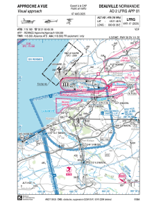


LFRG - Deauville Normandie
Located in Deauville, France
ICAO - LFRG, IATA - DOL
Data provided by AirmateGeneral information
Coordinates: N49°21'48" E0°9'36"
Elevation is 479 feet MSL.
Magnetic variation is 0.31° East View others Airports in Lower Normandy
Operational data
Special qualification required
Current time UTC:
Current local time:
Weather
METAR: LFRG 290930Z AUTO 20010KT 170V250 CAVOK 13/07 Q1017 NOSIG
TAF: TAF LFRG 290800Z 2909/2918 19008KT 9999 FEW020 PROB30 TEMPO 2917/2918 4500 -SHRA
Communications frequencies: [VIEW]
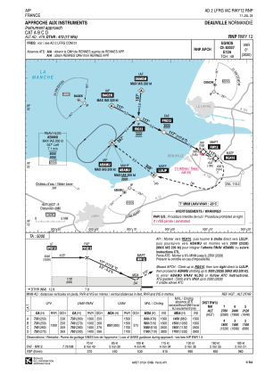
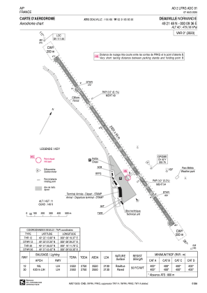
Runways:
| RWY identifier | QFU | Length (ft) | Width (ft) | Surface | LDA (ft) |
| 12 | 117° | 8366 | 148 | MACADAM | 6890 |
| 30 | 297° | 8366 | 148 | MACADAM | 6988 |
Airport contact information
Address: Deauville France

