


LFHP - Le Puy Loudes
Located in Le Puy, France
ICAO - LFHP, IATA - LPY
Data provided by AirmateGeneral information
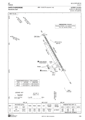
Coordinates: N45°4'47" E3°45'48"
Elevation is 2731 feet MSL.
Magnetic variation is 1.55° East View others Airports in Auvergne
Operational data
Special qualification required
Current time UTC:
Current local time:
Weather
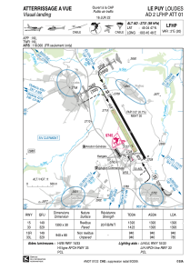
METAR: LFHP 271630Z AUTO 16019G32KT 130V200 9999 BKN042 BKN058 BKN160 12/03 Q1004
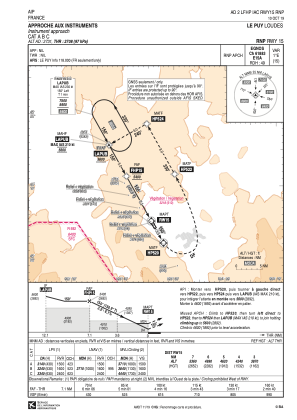
Communications frequencies: [VIEW]
Runways:
| RWY identifier | QFU | Length (ft) | Width (ft) | Surface | LDA (ft) |
| 15R | 151° | 3084 | 262 | GRASS | 3084 |
| 33L | 331° | 3084 | 262 | GRASS | 2575 |
| 15 | 151° | 4570 | 98 | ASPH | 4570 |
| 33 | 331° | 4570 | 98 | ASPH | 4570 |
Airport contact information
Address: Le Puy France

