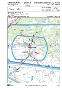
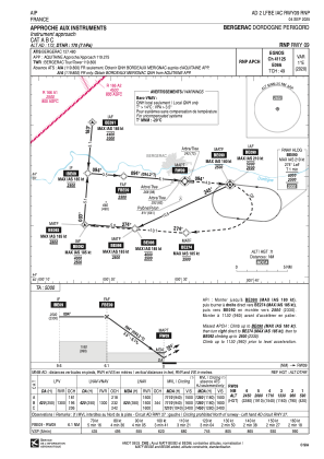
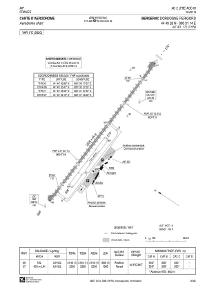


LFBE - Bergerac Dordogne Perigord
Located in Bergerac, France
ICAO - LFBE, IATA - EGC
Data provided by AirmateGeneral information
Coordinates: N44°49'28" E0°31'14"
Elevation is 172 feet MSL.
Magnetic variation is 0.69° East View others Airports in Aquitaine
Operational data
Special qualification required
Current time UTC:
Current local time:
Weather
METAR: LFBE 282300Z AUTO VRB02KT CAVOK 07/07 Q1017
Communications frequencies: [VIEW]
Runways:
| RWY identifier | QFU | Length (ft) | Width (ft) | Surface | LDA (ft) |
| 09R | 94° | 2526 | 197 | GRASS | |
| 27L | 274° | 2526 | 197 | GRASS | |
| 09 | 94° | 7234 | 148 | CONC+ASPH | 6348 |
| 27 | 274° | 7234 | 148 | CONC+ASPH | 6430 |
Airport contact information
Address: Bergerac France


