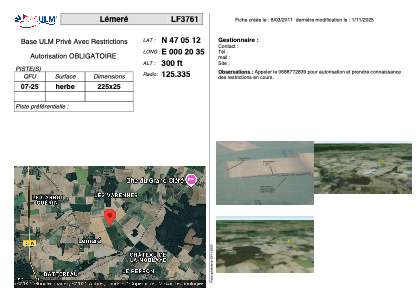


LF3761 - Lémeré
Located in Lémeré, France
ICAO - , IATA -
Data provided by AirmateGeneral information
Coordinates: N47°5'12" E0°20'35"
Elevation is 300 feet MSL.
View others Airports in Poitou-Charentes
Operational data
Special qualification required
Current time UTC:
Current local time:
Weather at : LFOT - Tours Val De Loire ( 48 km )
METAR: LFOT 071600Z AUTO 32006KT 300V360 9999 FEW048 BKN094 17/11 Q1021 TEMPO SCT030TCU
TAF: TAF LFOT 071100Z 0712/0812 01008KT CAVOK PROB40 TEMPO 0713/0718 -SHRA SCT030TCU
Communications frequencies: [VIEW]
Runways:
| RWY identifier | QFU | Length (ft) | Width (ft) | Surface | LDA (ft) |
| 07 | 0° | 738 | 82 | GRASS | |
| 25 | 0° | 738 | 82 | GRASS |
Airport contact information
Address: Lémeré France