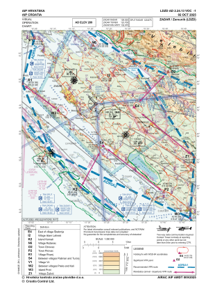
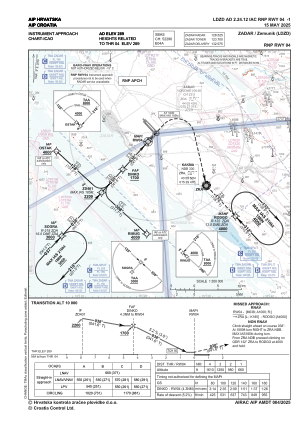
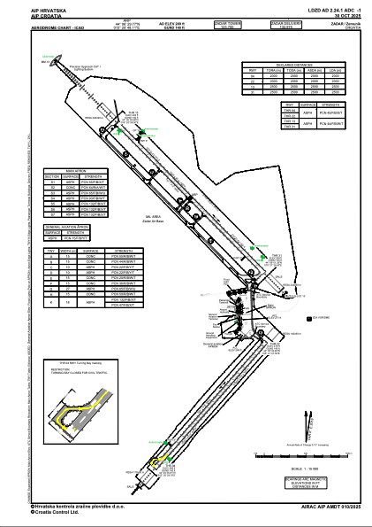


LDZD - Zadar / Zemunik
Located in Zadar, Croatia
ICAO - LDZD, IATA - ZAD
Data provided by AirmateGeneral information
Coordinates: N44°6'30" E15°20'48"
Elevation is 289 feet MSL.
Magnetic variation is +004° East View others Airports in Zadar
Operational data
Special qualification required
Current time UTC:
Current local time:
Weather
METAR: LDZD 122230Z VRB02KT CAVOK 13/10 Q1017
TAF: TAF LDZD 121725Z 1218/1318 VRB02KT CAVOK TX24/1311Z TN11/1302Z BECMG 1306/1308 13008KT BECMG 1310/1312 22007KT PROB30 TEMPO 1313/1316 TSRA FEW040CB BECMG 1314/1316 VRB02KT
Communications frequencies: [VIEW]
Runways:
| RWY identifier | QFU | Length (ft) | Width (ft) | Surface | LDA (ft) |
| 04 | 41° | 6518 | 132 | ASPH | 6562 |
| 22 | 221° | 6518 | 132 | ASPH | 6562 |
| 13 | 136° | 8156 | 141 | ASPH | 8202 |
| 31 | 316° | 8156 | 141 | ASPH | 8202 |
Airport contact information
Address: Zadar Croatia

