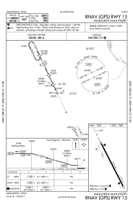


KOQW - Maquoketa Muni
Located in Maquoketa, United States
ICAO - OQW, IATA -
Data provided by AirmateGeneral information
Coordinates: N42°3'0" W90°44'20"
Elevation is 769 feet MSL.
Magnetic variation is 00° East View others Airports in Iowa
Operational data
Special qualification required
Current time UTC:
Current local time:
Weather at : KDBQ - Dubuque Rgnl ( 39 km )
METAR: KDBQ 150653Z AUTO 04008KT 10SM CLR 12/06 A2986 RMK AO2 SLP111 T01170061
TAF: KDBQ 150522Z 1506/1606 04007KT P6SM SKC FM152300 10005KT P6SM SCT250
Communications frequencies: [VIEW]
Runways:
| RWY identifier | QFU | Length (ft) | Width (ft) | Surface | LDA (ft) |
| 15 | 155° | 3304 | 60 | CONC | |
| 33 | 335° | 3304 | 60 | CONC |
Airport contact information
Address: Maquoketa United States