


KMYL - Mc Call Muni
Located in Mc Call, United States
ICAO - MYL, IATA - MYL
Data provided by AirmateGeneral information
Coordinates: N44°53'19" W116°6'6"
Elevation is 5024 feet MSL.
Magnetic variation is 13° East View others Airports in Idaho
Operational data
Special qualification required
Current time UTC:
Current local time:
Weather
METAR: KMYL 280351Z AUTO 09004KT 10SM FEW039 OVC050 06/02 A2995 RMK AO2 SLP141 T00560022
TAF: KMYL 272336Z 2800/2824 28009KT P6SM VCSH SCT025 BKN045 TEMPO 2800/2804 25015G25KT -SHRA BKN035 FM280400 VRB06KT P6SM SCT025 BKN050 FM281900 21007KT P6SM BKN100
Communications frequencies: [VIEW]
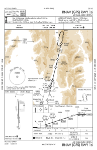
Runways:
| RWY identifier | QFU | Length (ft) | Width (ft) | Surface | LDA (ft) |
| 16 | 179° | 6101 | 75 | ASPH | |
| 34 | 359° | 6101 | 75 | ASPH |
Airport contact information
Address: Mc Call United States
Other aviation service providers
Flight schools

Mccall Mountain Canyon Flying Seminars, Llc.
Mccall Mountain Canyon Flying Seminars, Llc.
admin@mountaincanyonflying.com+1(208)634-1344