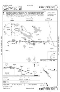


KMLT - Millinocket Muni
Located in Millinocket, United States
ICAO - MLT, IATA -
Data provided by AirmateGeneral information
Coordinates: N45°38'52" W68°41'8"
Elevation is 408 feet MSL.
Magnetic variation is -17° East View others Airports in Maine
Operational data
Special qualification required
Current time UTC:
Current local time:
Communications frequencies: [VIEW]
Runways:
| RWY identifier | QFU | Length (ft) | Width (ft) | Surface | LDA (ft) |
| 11 | 90° | 4713 | 99 | ASPH | |
| 29 | 270° | 4713 | 99 | ASPH | |
| 16 | 139° | 4000 | 100 | ASPH | |
| 34 | 319° | 4000 | 100 | ASPH |
Airport contact information
Address: Millinocket United States