


KEGE - Eagle County Rgnl
Located in Eagle, United States
ICAO - EGE, IATA - EGE
Data provided by AirmateGeneral information
Coordinates: N39°38'34" W106°54'57"
Elevation is 6547 feet MSL.
Magnetic variation is 09° East View others Airports in Colorado
Operational data
Special qualification required
Current time UTC:
Current local time:
Weather
METAR: KEGE 131956Z VRB04G17KT 10SM SCT090 21/M01 A3005 RMK AO2 SLP085 T02111011 PNO $
TAF: KEGE 131720Z 1318/1418 26005KT P6SM FEW060 SCT110 FM131900 27009G17KT P6SM VCTS SCT060CB BKN110 FM140000 14005KT P6SM FEW070 SCT150 FM140400 00000KT P6SM SCT200
Communications frequencies: [VIEW]
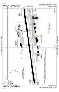
Runways:
| RWY identifier | QFU | Length (ft) | Width (ft) | Surface | LDA (ft) |
| 07 | 82° | 9000 | 150 | ASPH | 9000 |
| 25 | 262° | 9000 | 150 | ASPH | 8000 |
Airport contact information
Address: Eagle United States
