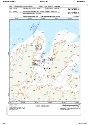
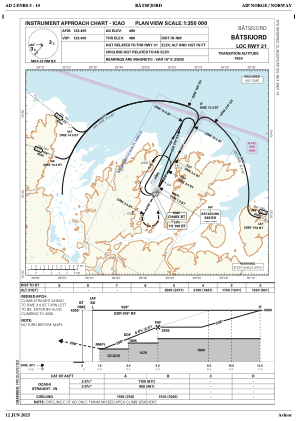
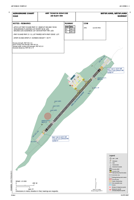


ENBS - Baatsfjord
Located in Baatsfjord, Norway
ICAO - ENBS, IATA - BJF
Data provided by AirmateGeneral information
Coordinates: N70°36'1" E29°41'33"
Elevation is 489 feet MSL.
Magnetic variation is 15.9° East View others Airports in Finnmark
Operational data
Special qualification required
Current time UTC:
Current local time:
Weather
TAF: TAF AMD ENBS 011455Z 0114/0119 31015KT 9999 SCT015 BKN025 TEMPO 0114/0119 1500 SHSNRA VV010 BECMG 0117/0119 04008KT
Communications frequencies: [VIEW]
Runways:
| RWY identifier | QFU | Length (ft) | Width (ft) | Surface | LDA (ft) |
| 03 | 44° | 3281 | 98 | ASP | |
| 21 | 224° | 3281 | 98 | ASP |
Airport contact information
Address: Baatsfjord Norway