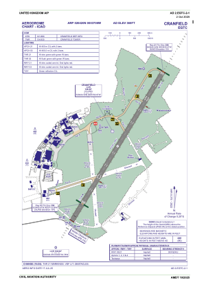


EGTC - Cranfield
Located in Bedford, United Kingdom
ICAO - EGTC, IATA -
Data provided by AirmateGeneral information
Coordinates: N52°4'20" W0°37'0"
Elevation is 360 feet MSL.
View others Airports in England
Operational data
Special qualification required
Current time UTC:
Current local time:
Weather
METAR: EGTC 280850Z 30013KT 9999 -RA FEW008 BKN022 06/05 Q1000
TAF: TAF EGTC 280759Z 2809/2817 30012KT 7000 RA SCT008 BKN020 TEMPO 2809/2811 3000 RADZ BR SCT004 BKN008 BECMG 2811/2814 22009KT 9999 NSW TEMPO 2811/2815 BKN010 PROB30 TEMPO 2815/2817 8000 -SHRA
Communications frequencies: [VIEW]
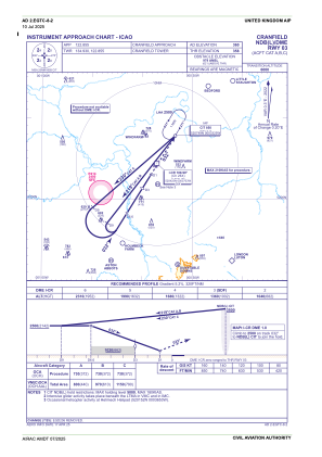
Runways:
| RWY identifier | QFU | Length (ft) | Width (ft) | Surface | LDA (ft) |
| 03 | 32° | 5902 | 148 | ASP | |
| 21 | 212° | 5902 | 148 | ASP |
Airport contact information
Address: Bedford United Kingdom
Handlers

Other aviation service providers
Flight schools

Coulson Flying Services Limited T/A Cranfield Flying School
Coulson Flying Services Limited T/A Cranfield Flying School
info@cranfieldflyingschool.com+44 01234752272