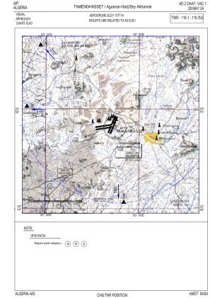
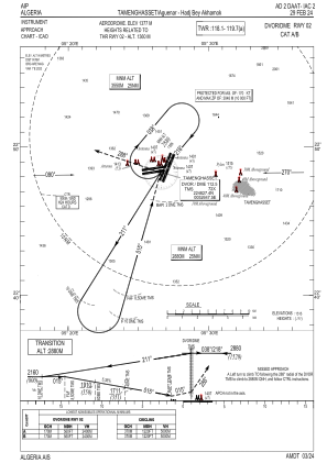


DAAT - Tamenghasset/Aguenar-Hadj Bey Akhamok
Located in Tamenghasset, Algeria
ICAO - DAAT, IATA - TMR
Data provided by AirmateGeneral information
Coordinates: N22°48'40" E5°27'3"
Elevation is 4517 feet MSL.
Magnetic variation is 1° East View others Airports in Tamanghasset Province
Operational data
Special qualification required
Current time UTC:
Current local time:
Weather
METAR: DAAT 162100Z 32009KT 9999 SCT046 SCT100 31/M01 Q1022
TAF: TAF DAAT 161700Z 1618/1718 22010KT CAVOK BECMG 1620/1622 34008KT BECMG 1705/1708 12012KT
Communications frequencies: [VIEW]
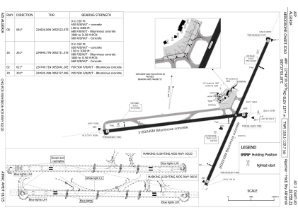
Runways:
| RWY identifier | QFU | Length (ft) | Width (ft) | Surface | LDA (ft) |
| 02 | 22° | 11483 | 148 | ASP | |
| 20 | 202° | 11483 | 148 | ASP | |
| 08 | 82° | 10335 | 148 | ASP | |
| 26 | 262° | 10335 | 148 | ASP |
Airport contact information
Address: Tamenghasset Algeria