


SSKT - Aeroclube De Santa Catarina
Located in Sao Jose, Brazil
ICAO - SSKT, IATA -
Data provided by AirmateGeneral information
Coordinates: S27°36'43" W48°40'24"
Elevation is 22 feet MSL.
Magnetic variation is -19.710694487° East View others Airports in Santa Catarina
Operational data
Special qualification required
Current time UTC:
Current local time:
Weather at : SBFL - Hercílio Luz ( 14 km )
METAR: SBFL 171300Z 35009KT 9999 FEW013 SCT038 22/20 Q1012
TAF: TAF SBFL 170900Z 1712/1812 33012KT 9999 SCT020 TX23/1717Z TN18/1808Z PROB40 TEMPO 1712/1715 8000 -RA BKN010 BECMG 1718/1720 18007KT BKN020 BECMG 1721/1723 8000 -RA BKN020 FEW030TCU PROB40 TEMPO 1804/1810 3000 BR BKN010 RMK PCQ
Communications frequencies: [VIEW]
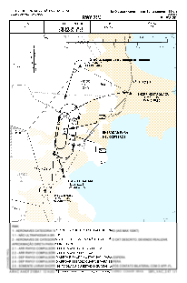
Runways:
| RWY identifier | QFU | Length (ft) | Width (ft) | Surface | LDA (ft) |
| 03 | 0° | 3947 | 59 | ASPH | |
| 21 | 0° | 3947 | 59 | ASPH |
Airport contact information
Address: Sao Jose Brazil
