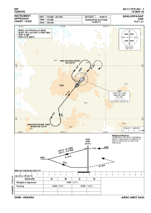
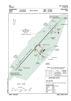


LTCS - Sanliurfa Gap
Located in Sanliurfa, Turkey
ICAO - LTCS, IATA - GNY
Data provided by AirmateGeneral information
Coordinates: N37°27'24" E38°54'29"
Elevation is 2708 feet MSL.
Magnetic variation is 5.5° East View others Airports in Sanliurfa
Operational data
Special qualification required
Current time UTC:
Current local time:
Communications frequencies: [VIEW]
Runways:
| RWY identifier | QFU | Length (ft) | Width (ft) | Surface | LDA (ft) |
| 04 | 42° | 13123 | 148 | CONC | 13123 |
| 22 | 222° | 13123 | 148 | CONC | 13123 |
Airport contact information
Address: Sanliurfa Turkey