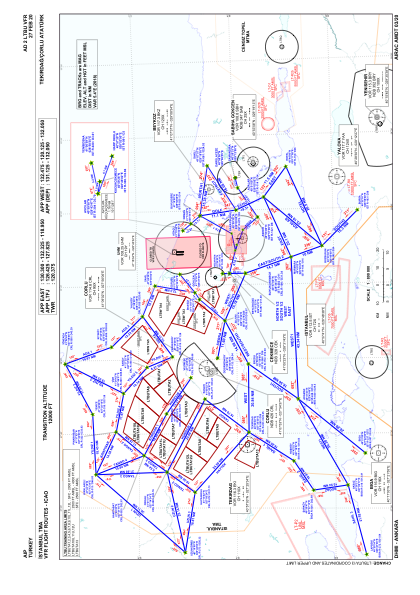
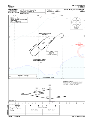
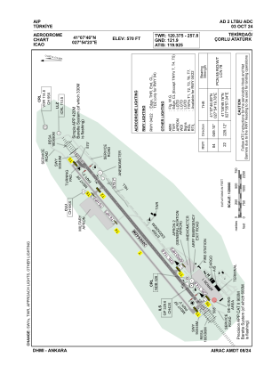


LTBU - Tekirdag Corlu Ataturk
Located in Tekirdag, Turkey
ICAO - LTBU, IATA - TEQ
Data provided by AirmateGeneral information
Coordinates: N41°7'46" E27°54'23"
Elevation is 570 feet MSL.
Magnetic variation is 5.3° East View others Airports in Tekirdag
Operational data
Special qualification required
Current time UTC:
Current local time:
Communications frequencies: [VIEW]
Runways:
| RWY identifier | QFU | Length (ft) | Width (ft) | Surface | LDA (ft) |
| 04 | 49° | 9843 | 148 | CONC | 9843 |
| 22 | 229° | 9843 | 148 | CONC | 9843 |
Airport contact information
Address: Tekirdag Turkey
