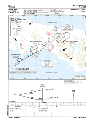
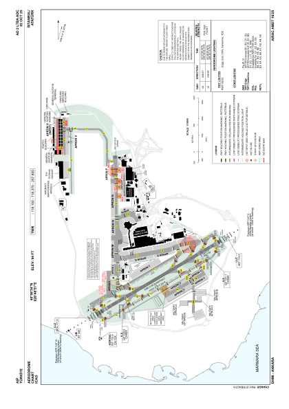


LTBA - Istanbul Ataturk
Located in Istanbul, Turkey
ICAO - LTBA, IATA - ISL
Data provided by AirmateGeneral information
Coordinates: N40°58'34" E28°48'51"
Elevation is 94 feet MSL.
Magnetic variation is 5.4° East View others Airports in Istanbul
Operational data
Special qualification required
Current time UTC:
Current local time:
Communications frequencies: [VIEW]
Runways:
| RWY identifier | QFU | Length (ft) | Width (ft) | Surface | LDA (ft) |
| 05 | 59° | 8465 | 197 | ASPH | 8038 |
| 23 | 239° | 8465 | 197 | ASPH | 8465 |
Airport contact information
Address: Istanbul Turkey